Bikepacking in Henry Coe State Park
March 8, 2020
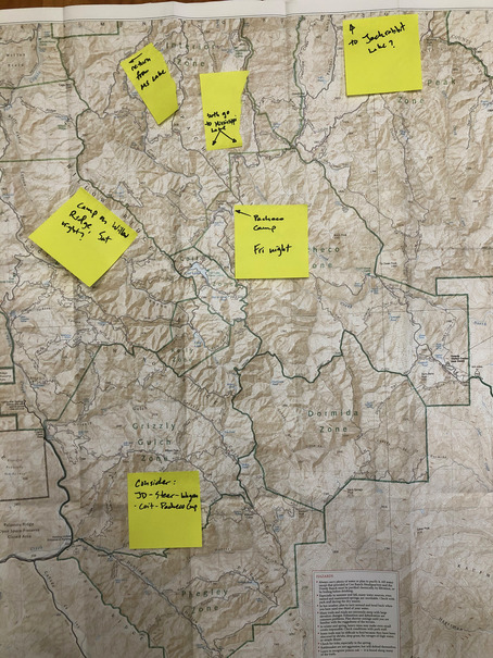
The rest of my family was heading off to Southern California for some college visits, leaving me to my own ends for three days… the weather has been unseasonably dry and warm, downright spring-like according to the flowers and grass which have taken off like it was May, so some kind of big outdoor adventure seemed in order. “Aha” I thought, “I shall go bikepacking into the depths of Henry Coe! That will keep me entertained for all of three days!”
I didn’t expect the forecast to change from the balmy weather we’ve been having for weeks, to the prospect of an incoming cold front and rain, but the forecast didn’t call for anything like a torrential downpour so I figured I’d HTFU and just go.
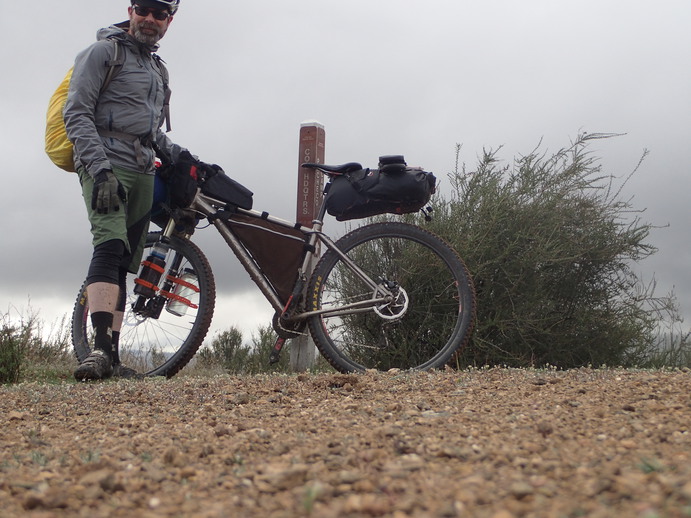
After I dropped the family off at the airport at 7am, I headed straight for the Hunting Hollow park entrance, arriving by 8am. I fed the Iron Ranger his due and filled out a backcountry camping permit, and was on my way up the Jim Donnelly trail.
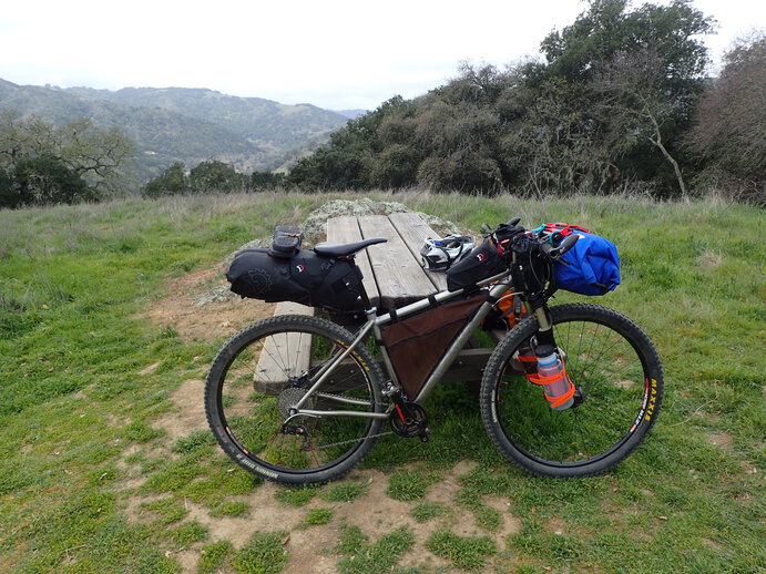
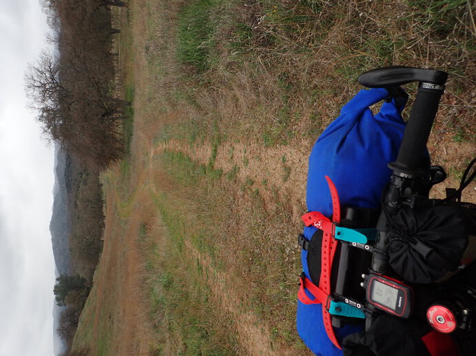
The first portion of Jim Donnelly was a stiff reminder that climbing with a load is more work than unloaded… well duh, but that was sure a wake-up call for the legs! I took a breather at the picnic table half-way up and appreciated the view down into Hunting Hollow.
The climbing continued, although my legs were warmed up now and it didn’t feel as hard.
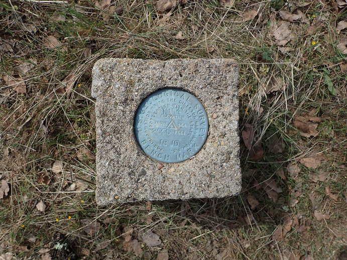
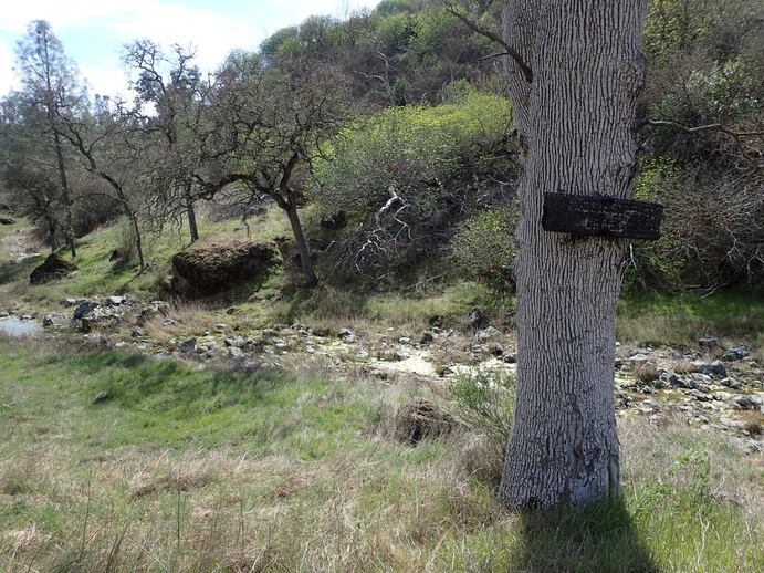
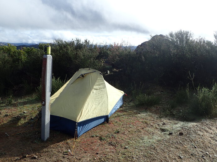
I always stop when I see a monument, and I was pretty surprised I had never noticed this one before on all the rides I’ve done through this area and on this very road! I chalk it up to traveling at “touring speed”. You see more at this pace, and stopping to let your legs/lungs catch up is a matter of course.
I arrived at Pacheco Camp by noon, having seen not a soul all morning, and cooked up some coffee and a cup of soup. A fellow on an eMTB pulled in and we chatted a bit; his bike has allowed him, at age 65, to get into the park and have a great day of it. I was sure tempted to just camp right there at Pacheco, as it is really the most luxurious camping to be had at Coe – running water, a potty hut, flat ground, picnic tables… but it felt too early to stop. I figured I could certainly make it to Orestimba Corral, another five miles or so, and then assess. I came to Mississippi Creek after a climb, and while there wasn’t much water in it, it felt like I was really back in the boonies with the rustic sign and pretty little draw that the creek runs through.
It’s not a bad climb out of Pacheco, and then a 500 ft descent to Orestimba creek, and another flat mile or two to the corral. Nobody out there, but the creek (while it had water) was looking kind of skanky, and my legs still felt OK - so I decided to carry on, and aim for Jackrabbit Lake.
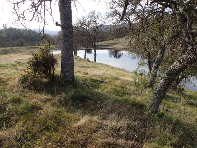
Following quite a few creek crossings, I came to the lake turn-off, and rode in a couple miles. There’s a steep pitch down to the lake, which I dreaded coming back up in the morning… but the road in was really pretty, rolling through oaks and then arriving at a charming little lake, home to lots of ducks making happy little ducky noises.
After setting up my tent and camp on a knoll overlooking the lake, I filled up water bottles and cooked dinner. A full moon rose. I worried about the forecast rain, supposed to arrive after midnight - I tucked away all my gear, in anticipation of wetness. Aside from a couple brief bouts of wind, though, nothing came through that night.
It looked in the morning like the weather was indeed starting to change. I wasn’t in a rush to get going, but I also didn’t want to get caught by a rain squall. I ate breakfast and got things packed up, and headed out the way I came. Fortunately, the dreaded slog back up the steep pitch didn’t feel nearly as bad as I had feared, and the route back out the creek was just downhill enough to be fun.
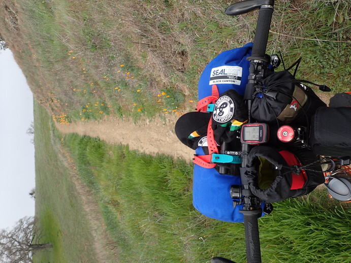
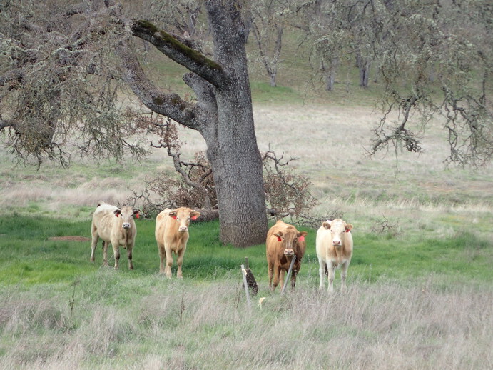
I worked my way back out Orestimba Creek, and after crossing the creek yet another time, found myself standing right next to the Orestimba Creek Trail marker. Single track sounded good right then, so off I went! The trail was in little-used but decent condition, no poison oak in evidence and only a couple of down trees to climb over; it switchbacked up at a reasonable grade for a bit then made a nice gradual descent above the creek, eventually coming in to the backside of Orestimba Corral. I passed four very suspicious-looking cows. I don’t think they see a whole lot of people back there.
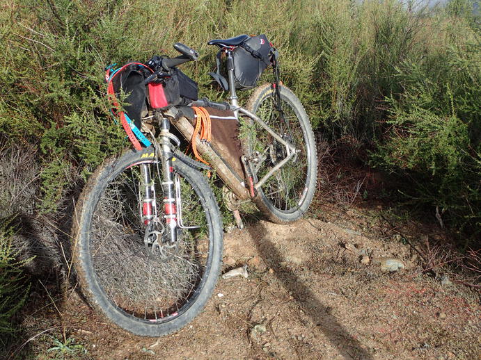
Riding the fully-loaded mountain bike on the single track is a different experience - it’s more like riding a motorcycle, because it is (a) quite a bit heavier than usual, about double in this case, so the bike accelerates downhill much faster than usual, and (b) you can’t actually see the front wheel, so placing the bike on a narrow trail or navigating some rocks or other obstacles, becomes a matter of intuition. It’s different enough to be quite jolly! The payback, of course, comes due as soon as the road or trail points upward…
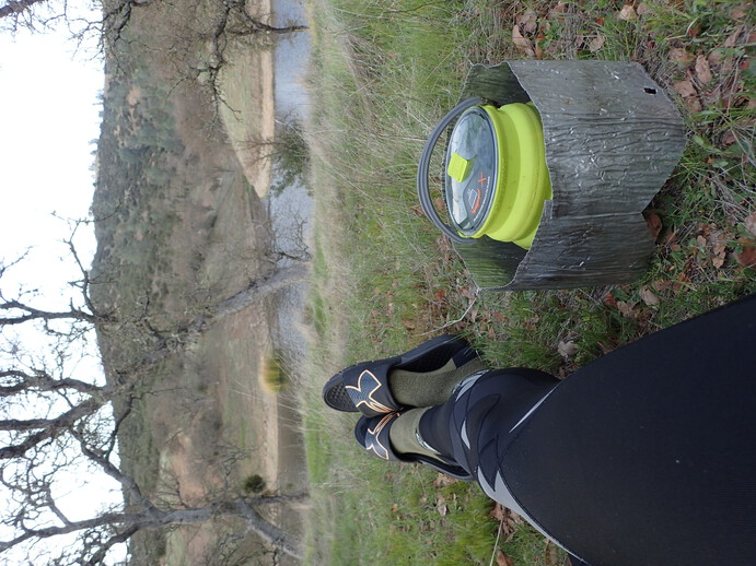
Climbing back out from Orestimba meant a 500-ft ascent in about a mile, not so bad under ordinary circumstances, but the heavy bike made it a real slog. The weather was, at last, starting to listen to the forecast, and the clouds thickened. Eventually I was looking down into the area I had been riding along the creek trail and beyond, from across the wilderness area. Onward I climbed towards Mississippi Lake, where I arrived just as the sprinkles did. This seemed a good opportunity for a warm lunch and coffee, and an assessment of where to sleep for the night.
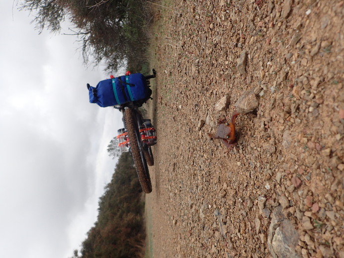
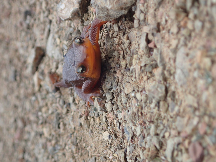
Mississippi Lake offered the temptation of a water source, potty hut, and picnic tables, but (as with yesterday) it seemed too early to stop. I figured, any miles I put in on the day, would be that many fewer I had to ride out on Sunday. Off I went, heading out Willow Ridge road. Thanks to the sprinkles, I kept encountering newts marching up the road - they all seemed to be tromping along uphill, and I started keeping a newt-count.
It didn’t take long for me to start questioning the merits of my decision to ride out Willow… it’s the epitome of Coe, where no concession was made to contouring the old ranch roads. They just go directly over whatever is on the ridge, no matter how steeply up or down it pitches. Every time I came to a trail that diverted off to Pacheco Camp, I considered following, but they all dive down into the creeks and I didn’t want to fight poison oak. Upwards (and downwards) I marched on, cursing Willow Ridge and making a literal note to myself to never, ever go that way again!
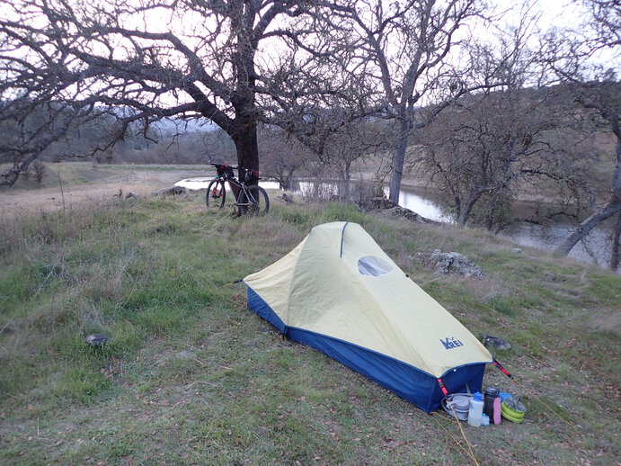
Arriving at what must be about the highest point in the park, at about 2,600 ft, I was ready to stop. The view was good, there was a nice spot off the edge of the road to put my tent, and I was done. An old, overgrown trail came up out of the brush right near where I was setting up - Eagle Pines trail, and evidently so unused that the nearby signpost no longer had that trail’s name officially on it, just some hand-scratched letters in the paint on the post. You can imagine my surprise when some guy came tromping up through that brush with a backpack on! He said it was really thick, much worse than the last time he hiked it ten years ago. It looked like a miserable route to me.
The rain had ceased, but the cold front had certainly moved in, and I was happy to crawl into my warm down bag and cook up some dinner. I had debated bringing the bulkier and heavier bag, vs my light and tiny down quilt, but with the forecast looking chilly I opted for the bag and was glad of that decision. The rain held off until about 2am, when it really started coming down. There seemed to be intermittent showers through the early hours of the morning, giving up by 7am or so. It was still cold, overcast, and very damp, so I had no expectation of my gear drying out before I wanted to get underway; but neither was I in any rush, so I had my leisurely coffee and oatmeal, contemplated the clouds rolling through the hills, and got stuff packed up.
From the high point on Willow Ridge, I rolled down (with a few more ups along the way, it’s Willow after all) and past Hoover Lake, Coit Lake, and finally down to Kelly Lake. The newt countCritter Count: newts: 11; cows (suspicious): 4; deer: 2. climbed to 11! From Kelly Lake, it’s just one big climb up to the next ridge, and then down Coit Road all the way to the pavement, and the last few miles back to Hunting Hollow. As I came down Coit, I started to encounter a few MTBers who timed their ride to start after the rain dispersed… it wasn’t exactly sunny out yet, but it was heading that way. When I arrived at the parking lot, it was packed with people heading out for their Sunday recreation! One fellow came over to say hi, he and some friends had bikepacked in on Saturday, but only as far as Hoover Lake (where they had a nice flat camping spot, but got pretty wet that night.) For the most part, on my 3-day ride, I saw almost no one… which made it feel like that much more of an adventure.